Services
Time lapse technology and project monitoring
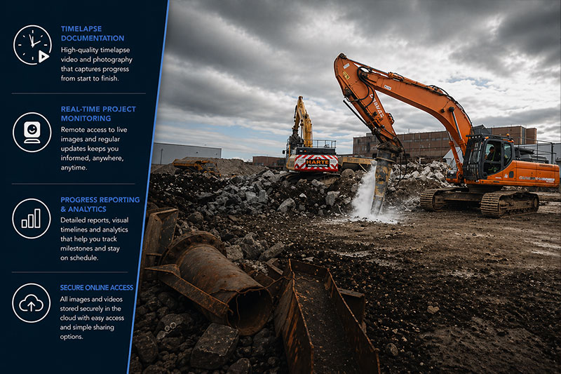
A reliable, high-quality timelapse solution delivering clear insight, remote access and powerful project visibility from start to finish.
Advancements in technology over recent years have significantly enhanced CWP’s ability to deliver high-quality timelapse photography and video solutions. Today’s systems are not only powerful recording tools but also highly effective platforms for real-time project monitoring, stakeholder engagement, and ongoing promotion of construction activity as it evolves.
Our integrated camera systems utilise professional DSLR equipment, capturing exceptional image quality suitable for a wide range of applications – from large-format print to high-definition video production, including full 4K output. Combined with secure 3G cellular connectivity, our systems enable seamless remote access, allowing project teams and stakeholders to view progress from anywhere in the world via a secure online portal.
We offer a fully managed, end-to-end service. This includes initial site assessment, system installation, ongoing monitoring, and final decommissioning, alongside the production of high-quality timelapse films and project deliverables. Cameras are remotely controlled, allowing precise configuration of capture intervals and scheduling to suit project requirements.
Our systems are built for reliability and performance. With advanced monitoring software providing daily status updates – including power levels and camera functionality – we ensure consistent operation throughout the project lifecycle. This robust approach allows CWP to deliver a dependable, high-quality timelapse service across Ireland.
Aerial photography & panos
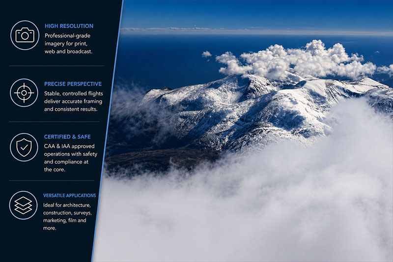
High-impact aerial imagery and immersive panoramas delivering clarity, scale and perspective for projects across every sector.
We provide a comprehensive range of aerial photography and video services, including aerial surveys, 360° aerial panoramas, private commissions, and specialist work for real estate, construction, golf courses, cinema and time-lapse projects. Our team combines technical precision with creative insight, ensuring every output is both visually compelling and fit for purpose.
In recent years, our focus has centred on construction and aerial documentation, alongside the development of an extensive online image library. This provides clients with immediate access to high-quality stock aerial photography, supporting marketing, planning and presentation requirements. We were early adopters of UAV technology, launching our aerial drone services in 2012 and becoming one of the first operators to deliver this capability across Ireland.
Architecture & interiors
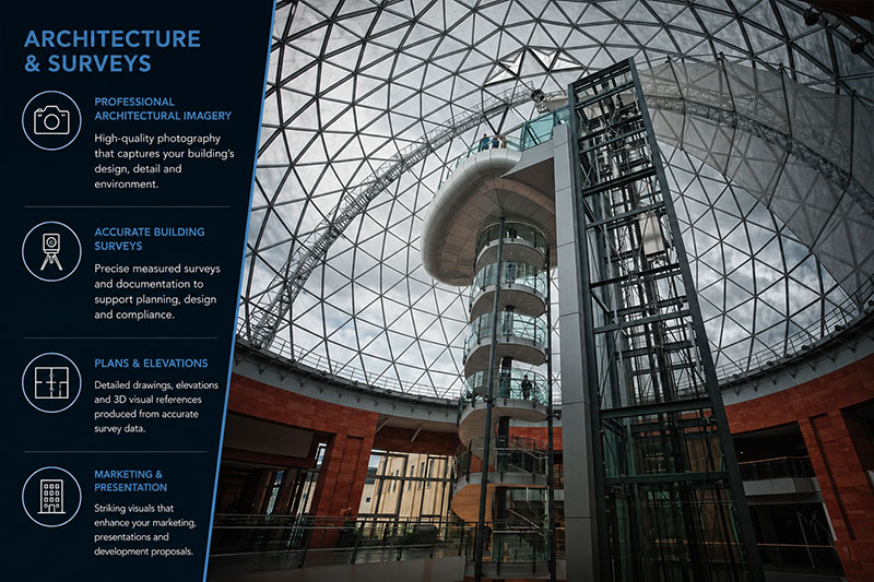
Precision-led photography and survey solutions delivering accurate, high-quality visuals that capture design intent, detail and spatial clarity.
Photographing architecture is one of the most technically demanding areas of our work, requiring precision, patience and a clear understanding of the client’s objectives. Whether the imagery is intended for documentation, marketing, or property promotion, each project demands a considered approach to ensure the final output supports its intended use.
In architectural photography, our focus extends beyond simply recording a structure. We take time to understand the design intent and the thinking behind the space. Our goal is to produce imagery that reflects not only the physical form, but also the atmosphere, character and vision that shaped the building from concept through to completion.
Our experience allows us to interpret space, light and perspective with confidence. This ensures that every image is composed with accuracy and purpose, giving clients confidence in a final result that aligns with their expectations. When combined with our wider service offering, this provides a comprehensive in-house solution for both visual documentation and survey requirements.
We utilise professional-grade equipment throughout, including industry-leading Canon EOS C300 systems for high-definition video, alongside premium L-series lenses and specialist tilt-shift optics. This enables us to deliver consistent, high-resolution results with precise control over perspective and detail.
UAV aerial work
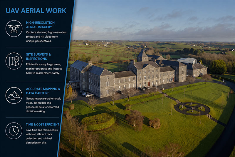
Safe, certified aerial imaging delivering dynamic perspectives, precise data and high-quality visuals from ground level to 400ft.
Following extensive research, flight testing and formal certification, we are fully qualified and approved by both the Civil Aviation Authority and the Irish Aviation Authority to undertake professional aerial photography. Using advanced unmanned aerial vehicles, we deliver striking imagery across a wide range of environments – from early morning through to dusk. Our approach combines technical expertise with creative execution, ensuring consistent, high-quality results that meet the demands of modern projects.
Our aerial systems enable us to capture perspectives that were previously difficult or costly to achieve. From vertical top-down imagery to sweeping oblique angles, and from ground level up to 400ft, we provide flexible coverage tailored to each brief. This allows clients to benefit from professional aerial outputs at a fraction of the cost associated with traditional methods.
Efficiency on site is a key strength. Setup is rapid, with most systems ready for flight in under 20 minutes, depending on location and conditions. Once airborne, our UAVs operate with stability and precision, supported by advanced sensors and safety systems. A fully stabilised three-axis gimbal allows for the use of multiple camera options, ranging from compact systems to cinema-grade equipment such as the GoPro and Canon EOS C300. This ensures flexibility in both photography and high-definition video capture.
Flight operations are designed to be efficient, quiet and environmentally considerate, with typical flight times of 10–15 minutes depending on payload. We maintain full backup capabilities for battery charging, even in remote or rural locations. Independent gimbal control allows for smooth, controlled camera movement, including full 360° panoramic sweeps and precise 90° vertical tilt, ensuring complete coverage of the subject.